Trail Snowshoes La Plagne-Tarentaise - Grant tour de Plagne  - Photo
 nave
nave

User

© OpenStreetMap contributors
Length
Length
17.8 km
Max alt
Max alt
2278 m
Uphill gradient
Uphill gradient
830 m
Km-Effort
Km-Effort  
29 km
Min alt
Min alt
1925 m
Downhill gradient
Downhill gradient
847 m
Boucle
Boucle
No
Creation date :
2021-04-03 09:10:08.909
Updated on :
2021-04-03 16:56:24.282

(0 Reviews)

Snowshoes
Snowshoes
4h40
Difficulty : Medium

Scan this QR Code to open this trail in the SityTrail application

FREE GPS app for hiking

Logo SityTrail SityTrail

IGN / Geographical institutes

Download SityTrail from the App Store Download SityTrail from Google Play

Logo SityTrail SityTrail World

The world is yours!

Download SityTrail from the App Store Download SityTrail from Google Play Download SityTrail on Huawei AppGallery

About

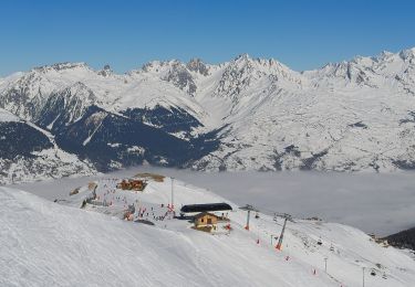
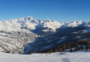
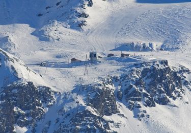
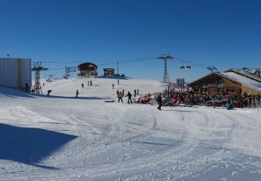
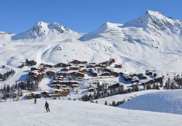
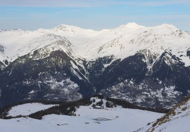
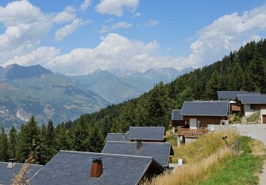
Trail Snowshoes of 17.8 km to be discovered at Auvergne-Rhône-Alpes, Savoy, La Plagne-Tarentaise. This trail is proposed by nave.

Description

Plagne bellecote - Col de Forcle - Belle Plagne - Bellecote - Plagne Centre - Aime 2000 - Belle Plagne par Balcon - Plagne bellecote

Elevation profile

Positioning

Country:
France
Region :
Auvergne-Rhône-Alpes
Department/Province :
Savoy
Municipality :
La Plagne-Tarentaise
Location:
Mâcot-la-Plagne
Start:(UTM)
320311 ; 5042333 (32T) N.

Trails nearby

Trail On foot Aime-la-Plagne - Le Mont Jovet - Photo
On foot
PRO

On foot

Medium
Aime-la-Plagne, Auvergne-Rhône-Alpes, Savoy, France
11.1 km | 21 km-effort
4h 45min
Yes
Trail On foot La Plagne-Tarentaise - Les Frasses - Photo
On foot
PRO

On foot

Easy
La Plagne-Tarentaise, Auvergne-Rhône-Alpes, Savoy, France
5.7 km | 7.8 km-effort
1h 45min
No
Trail On foot La Plagne-Tarentaise - Boucle du Carroley - Photo
On foot
PRO

On foot

Easy
La Plagne-Tarentaise, Auvergne-Rhône-Alpes, Savoy, France
4.2 km | 7.5 km-effort
1h 41min
No
Trail On foot La Plagne-Tarentaise - Sentier Découverte Grande Rochette - Photo
On foot
PRO

On foot

Easy
La Plagne-Tarentaise, Auvergne-Rhône-Alpes, Savoy, France
9.2 km | 16.3 km-effort
3h 42min
Yes
Trail On foot La Plagne-Tarentaise - Boucle de Roche de Mio - Photo
On foot
PRO

On foot

Easy
La Plagne-Tarentaise, Auvergne-Rhône-Alpes, Savoy, France
5.6 km | 12.1 km-effort
2h 44min
No
Trail On foot Aime-la-Plagne - Route Balcon - Photo
On foot
PRO

On foot

Easy
Aime-la-Plagne, Auvergne-Rhône-Alpes, Savoy, France
7.4 km | 9.6 km-effort
2h 11min
No
Trail On foot La Plagne-Tarentaise - Le Lac Vert - Photo
On foot
PRO

On foot

Easy
La Plagne-Tarentaise, Auvergne-Rhône-Alpes, Savoy, France
4.6 km | 7 km-effort
1h 36min
Yes
Trail Walking Peisey-Nancroix - Peisey Vallandry Les Rossets Col d'Entreporte  - Photo
Walking
GUIDE
lhomme.ph

Walking

Difficult
Peisey-Nancroix, Auvergne-Rhône-Alpes, Savoy, France
14.3 km | 26 km-effort
4h 51min
Yes
Trail Walking Peisey-Nancroix - Peisey Vallandry Les Charmettes Le Villaret - Photo
Walking
GUIDE
lhomme.ph

Walking

Medium
Peisey-Nancroix, Auvergne-Rhône-Alpes, Savoy, France
6.3 km | 8.6 km-effort
1h 47min
No


Close
My subscriptions